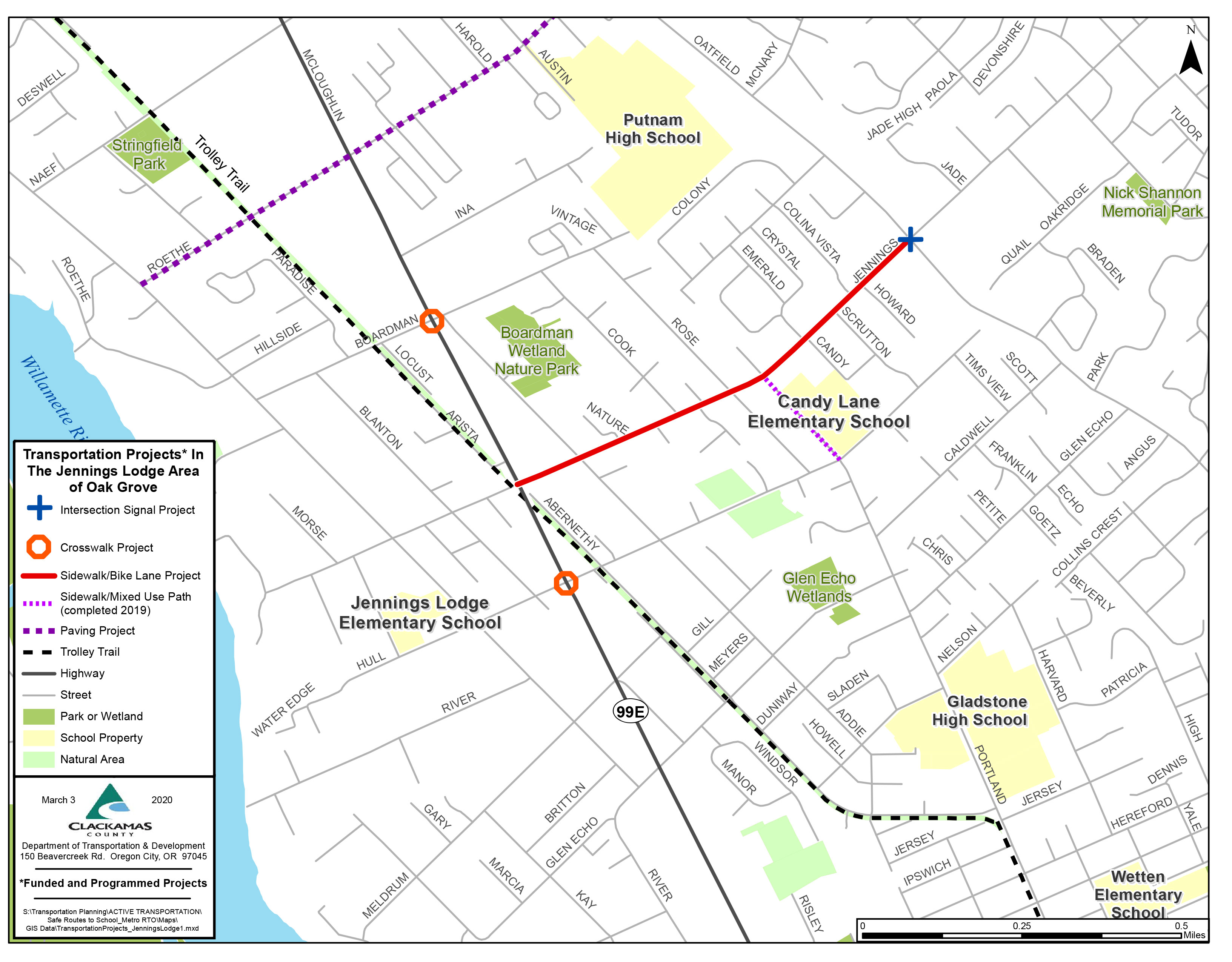
Improving safety and connectivity for pedestrians, cyclists, and motorists along SE Jennings Ave.
This project, along SE Jennings Ave. between Highway 99E (McLoughlin Blvd.) and SE Oatfield Road, will help connect residents to nearby businesses and transportation options, and provide safe routes for students to travel to local schools in the area.
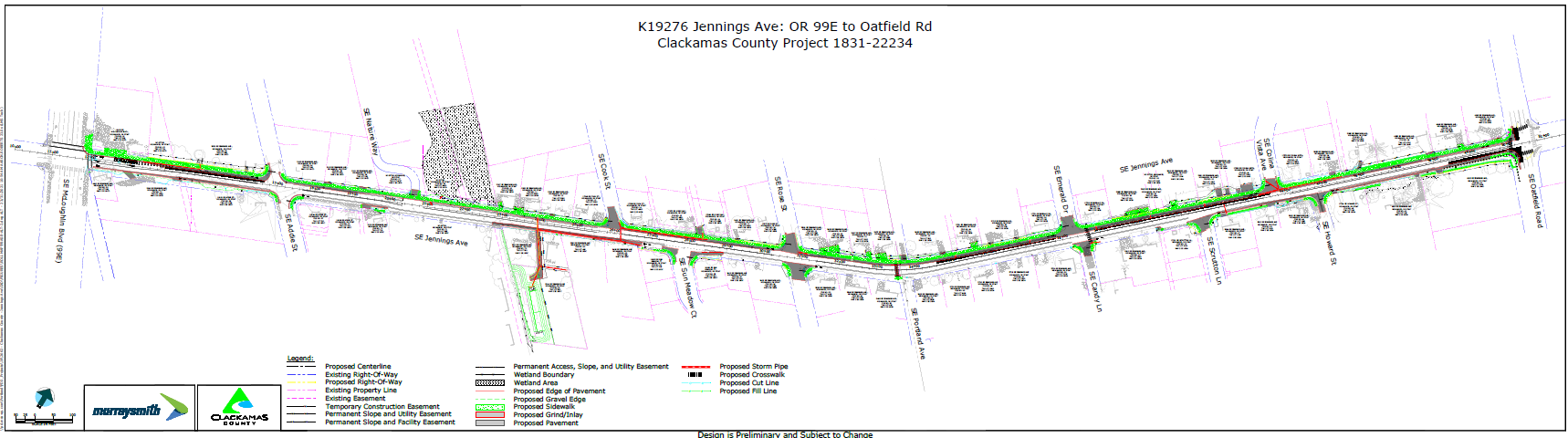
Proposed design for all of SE Jennings Ave. within the project limits.
Schedule
Bids were received and contract was awarded in February 2024 to Emery and Son’s Construction.
- Project planning and design: Nov. 2019 – Nov. 2023
- Right of Way Acquisition Efforts: Jan. 2021 – Sept. 2023
All right of way acquisitions are conducted as required by state and federal law. Read right of way brochure: English | Spanish. - Construction: May 2024 – July 2024
Traffic impacts
- No traffic impacts during winter pause
- When construction starts up in the spring, expect work between 7 a.m. and 6 p.m., Monday–Friday, and Saturdays as needed.
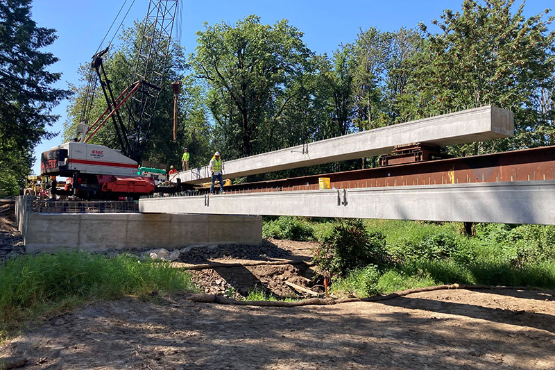
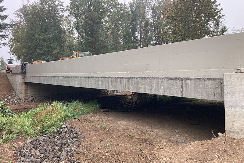
- Due to unforeseen conditions with the retaining walls and subsequent supply chain issues for our replacement materials, the project schedule is delayed.
As weather allows, work will continue through the winter to finish the final large wall between Hwy99 and Addie St., sidewalks and road widening between Mcloughlin Blvd and Boardman Creek.
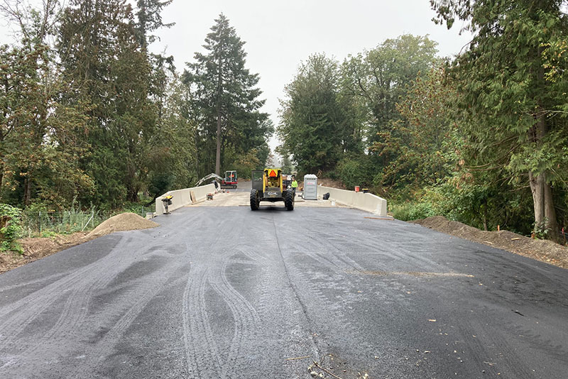
In the spring the road will be prepped for paving, and then painted with road striping after the curing period. Estimated completion of paving June 1-30, 2025.
Engineer/consultant
Nicholas McMurtrey, PE; Murraysmith, Inc.
Things to be aware of
Traveler Safety FAQs
This section of Jennings Ave. is being considered now because it best fit the criteria for Metro’s Regional Flexible Funds Allocation funding program (a key funding source). It is the appropriate size and had already been identified as a high priority project in the Clackamas County Transportation System plan.
In 2013, Clackamas County requested funds for this project from Metro’s Regional Flexible Funds Allocation (RFFA) program, a process used by Metro to distribute federal money to local projects. In November 2013, Metro notified the county that they had awarded funds for this project to begin in 2016–2018. Since the project was not fully funded, the county needed to identify additional funding sources. Once additional funding was identified and the county completed the contracting process with the Oregon Department of Transportation, we were able to begin working on the project in 2019.
Plans for work on other portions of Jennings Ave.
The Clackamas County Transportation System Plan (TSP) includes improvements of bike lanes and sidewalks for the entire length of Jennings Ave. between McLoughlin Road and Webster Road. Project priorities in the TSP were developed with input from the community and adopted by the Board of County Commissioners.
- The current project between Oatfield and McLoughlin is a Tier 1 (top) priority projects
- The segments between River Road and Oatfield are identified as Tier 1 (top) priority projects (Project #1068).
- The segment between Oatfield Road and Webster Road is a Tier 2 (second level) priority project (Project #2021).
Projects along the other segments of Jennings, both the segment from River Road to Mcloughlin and the segment from Oatfield to Webster, will be constructed when we can get funding for them. We depend on outside funding sources for sidewalk and bike lane improvements and work diligently to match needed projects to funding from state and federal resources.
Notices will be sent to area residents and property owners at key points during the process.
Share your comments and ask questions.
Funding
- Estimated project cost: $8.6 million
- Funding sources: Oregon Department of Transportation (ODOT), Federal Highway Administration (FWHA) and Clackamas County
Other Resources
Project area
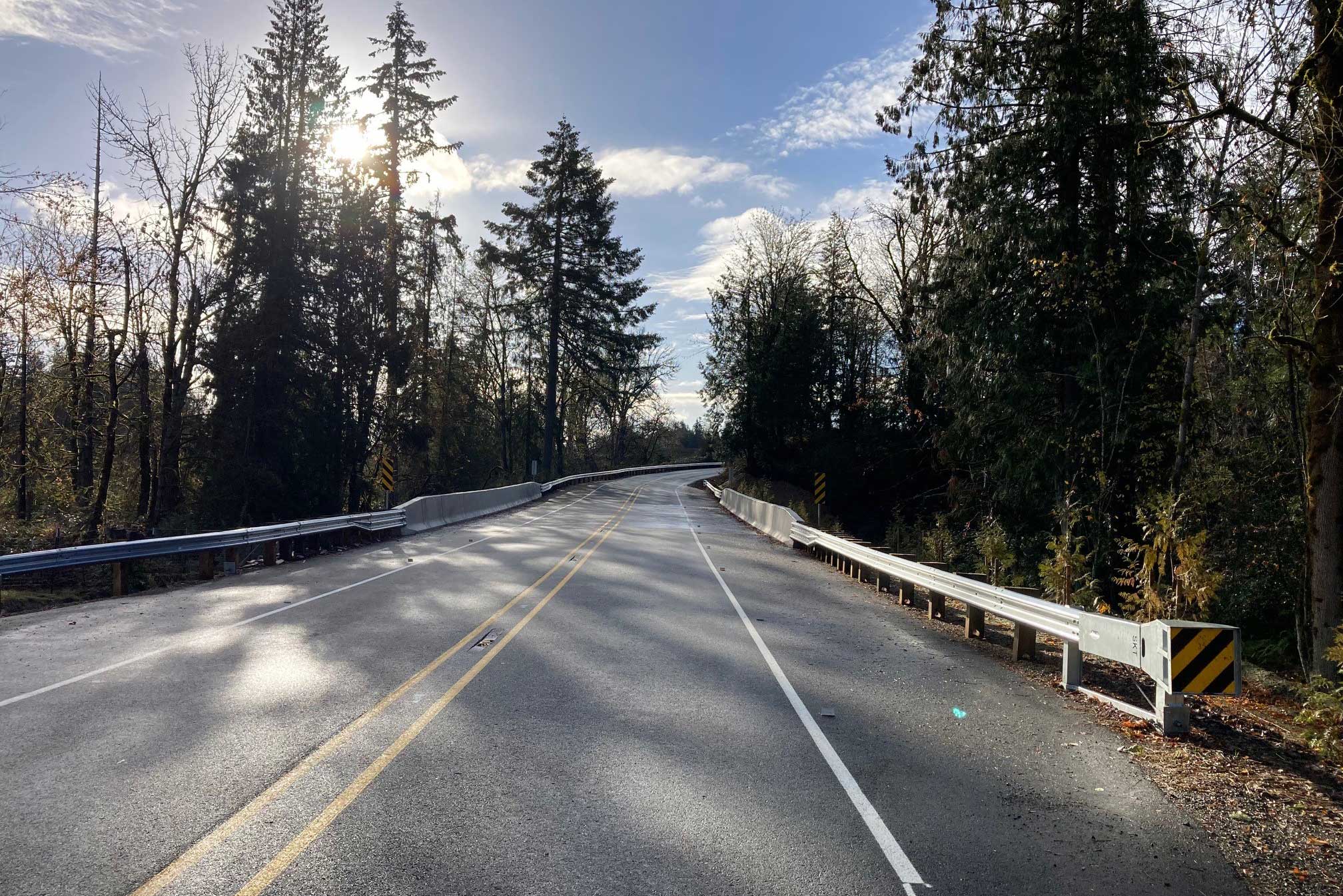
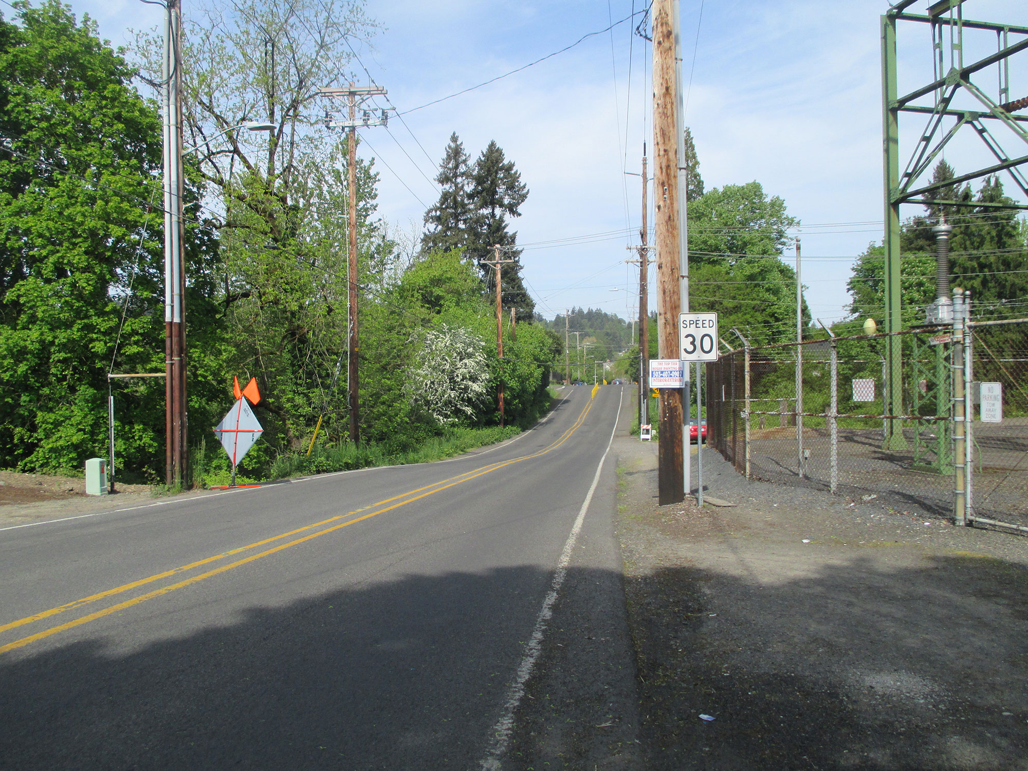
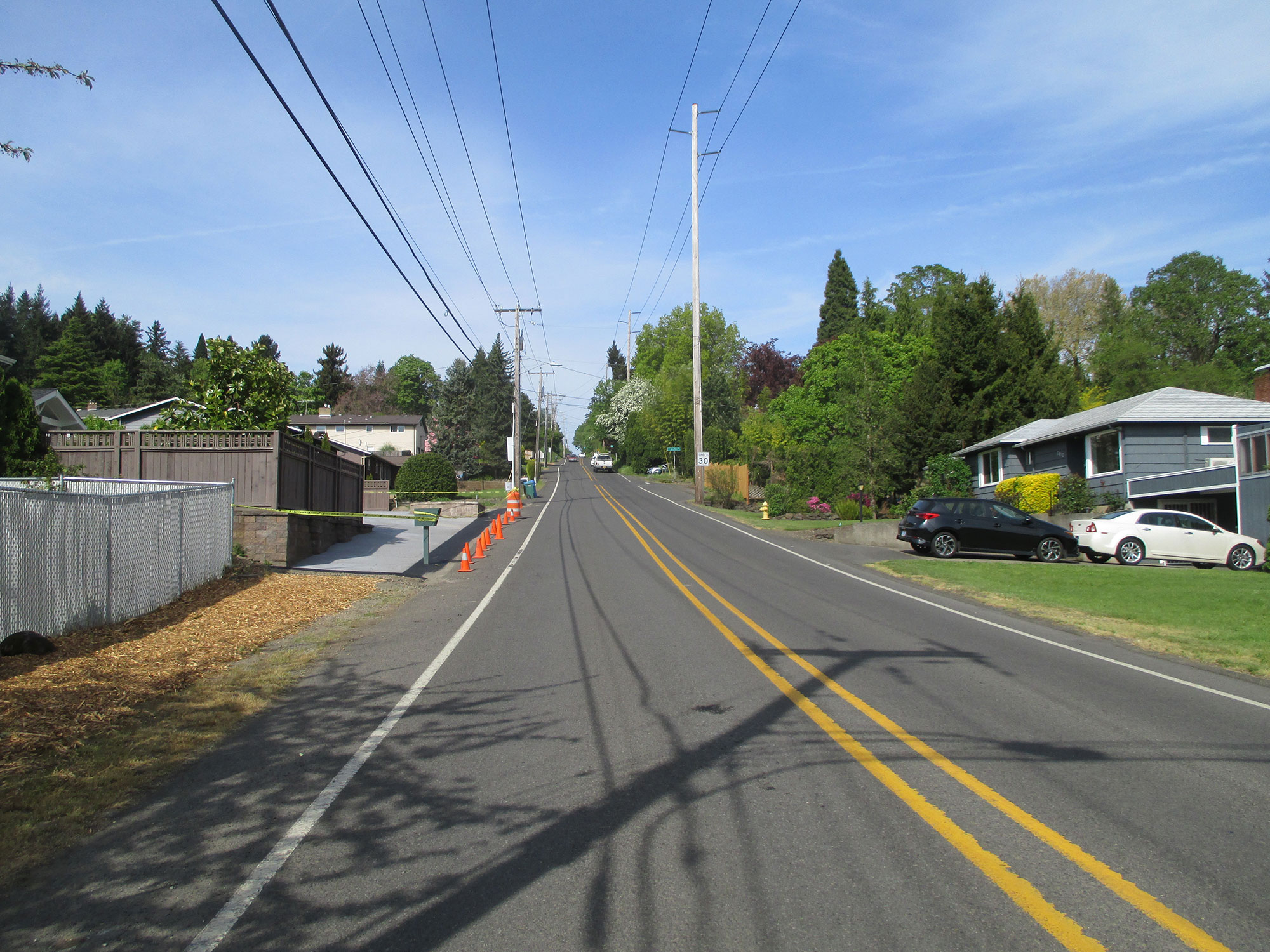
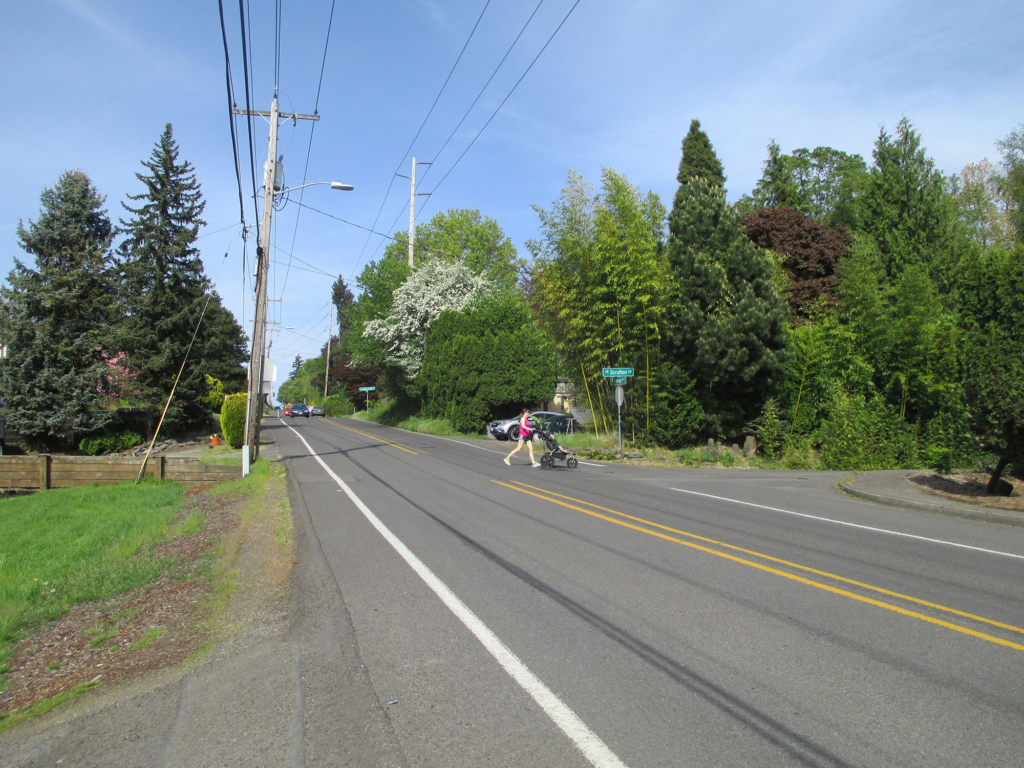
Existing conditions
There are many sections of SE Jennings Ave. without sidewalks or bike lanes. Some examples of these incomplete connections that will be completed as part of this project are shown below.
Traffic analysis
 Translate


 Projects funded through the new Community Road Fund will increase safety, relieve congestion and maintain local roads.