Disaster Management

Disaster Management

You May Need Flood Insurance!

Did You Know? Clackamas County typically gets between 43” to 88” of rain every year. Clackamas County is a member of the National Flood Insurance Program: Federal regulations impose a Mandatory Purchase Requirement on buildings located in the floodplain. This requires that lenders ensure property owners purchase flood insurance. It applies to all forms of federal or federally related financial assistance (including subsidized mortgages and other loans). Increased Cost of Compliance Coverage: This coverage is included in most standard flood insurance policies.  Claims for these benefits are filed separately from a claim for contents of building loss. In addition, certain eligible property owners can qualify for up to $30,000 to bring their home or business into compliance. These benefits can also be used to pay for required improvements to buildings that have been repeatedly or severely damaged by flooding.If you're a Clackamas County resident or property owner, you have the option to buy flood insurance whether or not you live in a floodplain. Contact an insurance company to purchase flood insurance. You may also contact the Planning Division at 503-742-4500 for additional information about County floodplain regulations and their relationship to FEMA’s National Flood Insurance Program (NFIP).

Here's why . . .

  • Homeowner and business insurance do not cover flood damage. Separate flood insurance must be purchased to cover flood damage and loss.
  • Just a few inches of flood water can cause tens of thousands of dollars in damage not covered by homeowners insurance. Over the past 10 years, the average flood claim has been nearly $48,000.
  • You're not just at risk of a flood if you live near a river; floods can also occur because of clogged drains, surface water back-ups and flash floods.
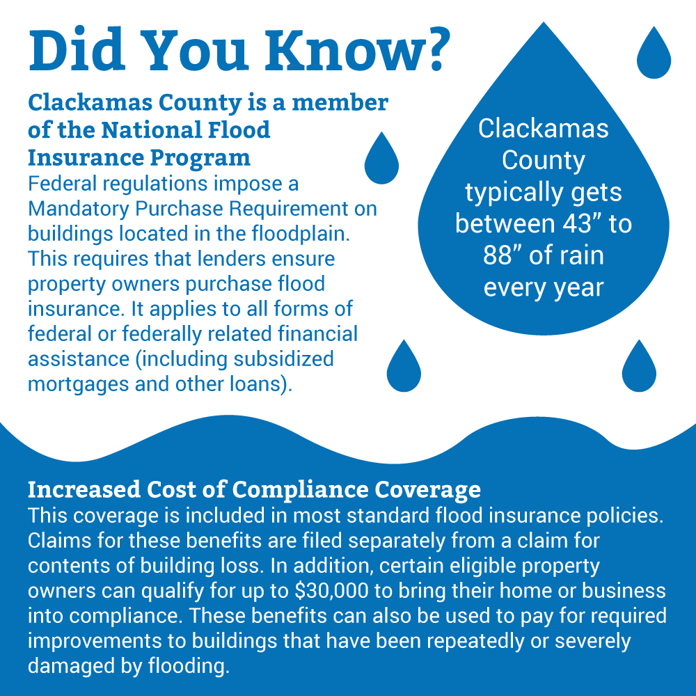
  • You don't have to be in a floodplain to buy flood insurance. Because Clackamas County is in the National Flood Insurance Program, all residents and business owners in unincorporated areas are eligible to buy flood insurance.
  • Flood insurance is the most economical protection from devastating financial loss from a flood. During the Sandy River flood in Jan. 2011, three houses were damaged beyond repair and one house was swept downstream. Three of those homeowners had up-to-date flood insurance coverage, including one outside of the mapped flood zone. The flood insurance covered most of their losses. The owner without flood insurance was left on their own to recover from the devastating loss.

Prepare for possible future floods

  • Buy flood insurance if you're in any floodplain, and consider it even if you're not, especially if you're near the Sandy River.
  • List all your personal property, including furnishings, clothing and valuables. Take pictures or video of your home and contents, especially high-value items; keep insurance policies, pictures, videos and lists of personal property in a safe place.
  • Put together a 72-hour disaster supply kit. For details, go to the American Red Cross or Ready.gov.
  • Consider ways to reduce long-term flooding risk, such as elevating your home or moving it to higher ground, building floodwalls or berms, flood-proofing and protecting utilities.
  • Plan how you would evacuate in the threat of a flood, such as what to take with you, the safest evacuation route and where to go.

Help prevent floods

Don't dump or throw anything into ditches or streams
A plugged channel cannot carry water, and when it rains, the excess water must go somewhere.

Remove debris, trash, loose branches and vegetation
Keep banks clear of brush and debris to help maintain an unobstructed flow of water in stream channels. Do not, however, remove vegetation actively growing on a stream bank, which is regulated by local, state and federal agencies.

Obtain a floodplain development permit and/or building permit, if required
To minimize damage to structures during floods, the county requires all new construction in the floodplain to be anchored against movement by floodwaters, resistant to flood forces, constructed with flood-resistant materials and flood-proofed or elevated so the first floor of living space, as well as all mechanical and services, is at least one foot above the elevation of the 100-year flood. These standards apply to new structures and to substantial improvements of existing structures. Most other types of development within the floodplain also require a floodplain development permit, such as grading, cut and fill, and bank stabilization techniques.

Flood Insurance rates rising to cover costs; County residents still eligible for discount

Flood insurance rates are increasing. The NFIP, founded in 1968, provided subsidized insurance rates to people with homes that did not meet minimum standards but were built before FEMA's new flood mapping existed. Now, after years of massive storms such as Hurricanes Katrina and Sandy, NFIP is out of money and deeply in debt. In order to help the program become solvent and build a reserve fund, federal legislation approved in 2012 requires that flood insurance rates reflect the flood risk of the property.

While some people with flood insurance will not see an increase because their rates already reflect their flood risk, others will need to pay significantly more based on their actual flood risk. Some rate changes have taken place, and others become effective October 1, 2013. Triggers for rate changes include policy lapses, map changes and property purchases.

As a NFIP member, the County must oversee floodplains based on Federal Emergency Management Agency (FEMA) standards. In turn, property owners must buy flood insurance for residences in the floodplain. By law, lending institutions require flood insurance for structures in a floodplain and have the option to require it for other areas.

For more information

Frequently Asked Questions

16916
New Format?
On

Hazardous Materials and Pollution

Chemical barrels

Chemicals are found everywhere. They purify drinking water, increase crop production and simplify household chores. You and your community are at risk if a chemical is used unsafely or released in harmful amounts into the environment where you live, work or play. Hazards can occur during production, storage, transportation, use or disposal.

Hazardous materials in various forms can cause death, serious injury, long-lasting health effects and damage to buildings, homes and other property. Many products containing hazardous chemicals are used and stored in homes routinely. These products are also shipped daily on the nation's highways, railroads, waterways and pipelines.

Chemical manufacturers are one source of hazardous materials, but there are many others, including service stations, hospitals and hazardous materials waste sites.

Varying quantities of hazardous materials are manufactured, used, or stored at an estimated 4.5 million facilities in the United States — from major industrial plants to local dry cleaning establishments or gardening supply stores.

Hazardous materials come in the form of explosives, flammable and combustible substances, poisons and radioactive materials. These substances are most often released as a result of transportation accidents or because of chemical accidents in plants.

How can I protect myself from a hazardous materials incident?

More Hazardous Materials Information

General Pollution Safety Information

New Format?
On

Clackamas Community Wildfire Protection Plan (CCWPP)

Clackamas Community Wildfire Protection Plan (CCWPP)The development of the Clackamas County Wildfire Protection Plan is a collaborative effort among local, state and federal agencies as well as community members that have a vested interest in reducing losses from wildfire events. The CCWPP meets the requirements set forth in the Healthy Forests Restoration Act and the National Fire Plan, while building upon the FEMA-approved Clackamas County Natural Hazard Mitigation Plan.

2024 Clackamas Community Wildfire Protection Plan

New Format?
On

Flooding Preparedness

Flooding poses a threat to life and safety and can cause severe damage to public and private property. River levels in Clackamas County are monitored by a network of river gauges that help us predict the when peak water levels will occur in our communities. We also work with fire districts to provide sand bag distribution locations to assist residents in protecting their homes from flooding.

If you find yourself in a flood warning zone:

  • Do not walk, swim or drive through flood waters. Turn Around, Don’t Drown!
  • Remember, just six inches of moving water can knock you down, and one foot of moving water can sweep your vehicle away.
  • Stay off bridges over fast-moving water.

Damage From Local Floods

Flooding events during the last 50 years have ravaged parts of Clackamas County. Some of the results of these events include:

1964
  • One man died when his house collapsed into Wildcat Creek.
  • Almost forty homes near the Brightwood area alone were completely destroyed with no trace of having been there.
  • The Oregon City Shopping Center was inundated by 34.5 inches of water, with the shopping basements of JCPenney and Grants being completely submerged.
2011
  • Nearly $4 million was needed for repairs to public infrastructure that included damages to Lolo Pass Road, the Zigzag River bridge and county Water Environment Services wastewater facilities.
  • At least 37 residential properties suffered significant bank erosion and face increased future erosion threats.

Documentary videos


New Format?
On

Volcanoes

Erupting volcano

The Pacific Northwest lies on the "Ring of Fire," an area of active volcanic activity surrounding the Pacific Basin. While only Mt. Hood and Mt. St. Helens are known to have had direct effects in the county in the past, any eruption in the Cascades is likely to have transportation and economic impact on Clackamas County indirectly.

The primary volcanic threat to lives and property in Clackamas County is depicted on the projected volcanic hazards map from Mt. Hood.

These hazards can threaten our county from near or distant eruptions and include:

  • Mud and debris flows that can sweep down river valleys for tens of miles
  • Ash clouds that drift downwind with ash fall potentially causing a severe medical and transportation hazard.

US Geological Survey Cascade Range Current Update

Mount Hood Earthquake Swarm Information

Prepare
For tips on preparing for volcanic hazards go to: FEMA: Volcano

You can view volcanic activity at Mount Saint Helens at the United States Forest Service volcano cam web site.

New Format?
On

Clackamas County Emergency Operations Plan

cover of emergency operations plan

The Emergency Operations Plan (EOP) is a framework that provides guidance for coordinated preparedness, response, and recovery activities in the county. It sets forth lines of authority and organizational relationships and shows how all actions will be coordinated. The Emergency Operations Plan is updated every 4 years, in accordance with state requirements.

The EOP describes procedures for how the county will organize in an emergency, including how departments and agencies will carry out various responsibilities and coordinate activities and resources. The plan identifies roles and responsibilities for each county department. The board approved the plan and it went into effect on March 31, 2022.  

Updating the county's EOP for 2026

Clackamas County Disaster Management (CCDM) is currently revising the County's Emergency Operations Plan.

CCDM is actively seeking input on the plan, particularly from community organizations who participate in emergency response or support community members during a disaster. Community-based organizations (CBOs) and faith-based organizations (FBOs) who have historically worked with Clackamas County during disaster response can expect outreach from CCDM in the months ahead, inviting you to participate in individual interviews, focus groups and surveying. If you represent an organization that has not previously worked with Clackamas County, but you’d like to receive outreach from the county to provide feedback on the County’s EOP, please email our project manager, Francis Pastorelle at fpastorelle@clackamas.us.

What kind of feedback are we looking for

The workgroup responsible for the EOP update is looking for specific feedback about the plan or any of its sections. Examples might include:

  • Are the roles and responsibilities outlined in the plan accurate?
  • Do the organizations named in the plan have adequate resources to carry out these responsibilities?
  • Do the planning assumptions and situation overview accurately portray the demographics and conditions in Clackamas County?
  • Do the emergency support functions clearly describe the County's protocols?
  • Have there been examples from past emergency activations that highlight gaps in the emergency plan?

While we value general feedback about the county’s approach to emergency management or feedback about past disaster response, these comments or suggestions may fall outside the scope of this plan update.

How to provide your feedback

Community members are invited to review the plan in full or individual sections of the plan using the links below. You can download copies of the plan, add your comments or suggested revisions, and email them to the project manager at fpastorelle@clackamas.us.

Thank you for your contributions to making Clackamas County a safer and more resilient community!

See full document (PDF) 
 

New Format?
On

Disaster Management

Before, during and after natural disasters, emergencies and crisis, we coordinate response activities and train incident personnel. We also work with cities and regional partners to promote emergency preparedness and improve incident response.